

Quick answer
A reykjanes peninsula driving tour typically covers 150 to 200 kilometers along Route 41, Route 42, and coastal access roads, forming a loop from Reykjavík that takes four to six hours with stops at key geothermal and coastal sites. The peninsula is accessible year-round on paved roads, with optimal daylight conditions between 09:00 and 16:00. Entry to public roads and natural sites is free, though parking fees apply at select locations.
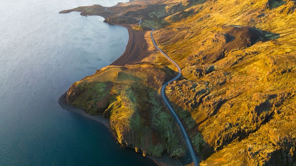
The Reykjanes Peninsula holds the youngest lava fields in Iceland, some formed within the past decade during the Fagradalsfjall and Sundhnúkur eruptions. The region's geology is visible at the surface: steaming fumaroles at Gunnuhver, sulfur-crusted vents at Seltún, and columnar basalt cliffs at Valahnúkamöl. A driving route across Reykjanes follows the southern coast from Reykjavík to Grindavík, then loops north through Reykjanesbær and back via Route 41. The main roads are paved and maintained through winter, though gravel F-roads near active eruption zones may close without notice. Cell coverage is reliable along the coast and near towns, but weakens inland near Þrenglaborgir crater row. The peninsula's compact geography allows bundling geothermal areas, lighthouses, and tectonic rift markers into a single circuit. Kleifarvatn lake sits in a collapsed volcanic caldera; the Reykjanesviti lighthouse marks Iceland's southwestern tip; the Bridge Between Continents spans a fissure in the Mid-Atlantic Ridge. Each stop adds fifteen to thirty minutes, and the route accommodates flexible pacing. A self-drive reykjanes peninsula tour avoids fixed departure schedules and group transport, letting travelers adjust for weather, light, or eruption activity. The peninsula's proximity to Keflavík Airport makes it a logical first or final day excursion for international visitors flying through Iceland. Road signage is bilingual, and most parking areas include information panels in English.
“The youngest lava fields in Iceland—some formed within the past decade—spread across the peninsula's interior, where active volcanism continues to reshape the landscape.”
Optimal Timing for a Reykjanes Peninsula Driving Tour
The best arrival window for a Reykjanes Peninsula driving tour is 09:00–16:00, which provides optimal daylight hours for exploring coastal sights safely. Visiting during these hours ensures maximum visibility for navigating the peninsula's volcanic terrain.
Summer (June–August)
High volume of visitorsMild temperatures, 10°C to 15°C. Long daylight hours allow for flexible exploration throughout the day.
Shoulder Season (May, September)
Moderate trafficVariable conditions, 5°C to 10°C. These months offer a balance between manageable crowds and sufficient daylight.
Winter (November–March)
Low visitor numbersFrequent storms, -2°C to 4°C. Expect very limited daylight and potential road closures due to high winds.
Weekday mornings
Light traffic— Plan your departure during the 09:00–16:00 window to utilize the safest light conditions.
Verdict: The optimal period is during the shoulder months of May or September, arriving between 09:00 and 16:00 to utilize the best daylight.
Suggested Reykjanes Peninsula Driving Tour Itinerary
This route suits self-drive visitors starting near Keflavík Airport and covers the peninsula's key geological and coastal features in a clockwise loop. Plan for 5–7 hours including stops.
Bridge Between Continents
Walk the footbridge spanning the Mid-Atlantic Rift, where the Eurasian and North American tectonic plates diverge. Allow 15 minutes.
Gunnuhver Hot Springs
Observe Iceland's largest mud pool and active fumaroles from wooden boardwalks; stay on marked paths due to unstable ground. Spend 30 minutes.
Reykjanesviti Lighthouse
Visit the peninsula's oldest lighthouse and scan the coast for seabirds; the cliffs offer views of the volcanic shoreline. Budget 20 minutes.
Garður Lighthouses
Stop at the twin lighthouses for a coastal break and watch waves roll in from the Atlantic. Allow 15 minutes.
Kleifarvatn Lake
Drive along the shore of this deep, eerie lake fed by underground springs; pull over at viewpoints for photos. Allocate 20 minutes.
Seltún Geothermal Area
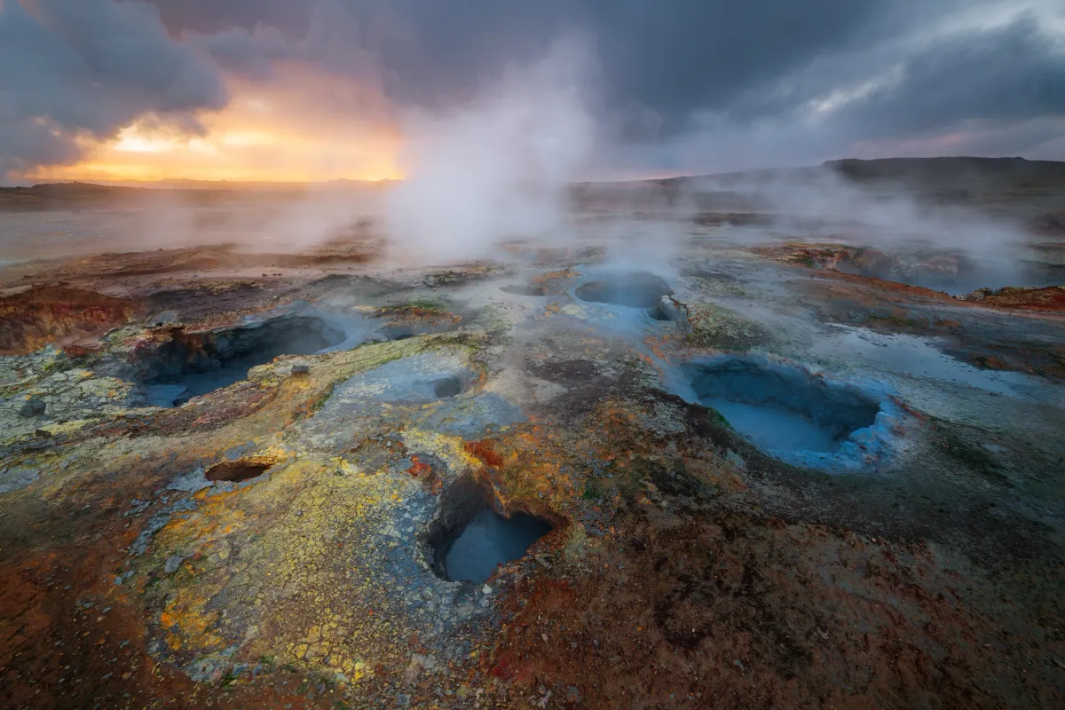
Walk the boardwalk loop past bubbling mud pots, sulfur deposits, and steaming vents in vivid yellow and orange. Plan 30–40 minutes.
Navigating the Reykjanes Peninsula Driving Tour
The Reykjanes Peninsula is located in southwestern Iceland, with Keflavik International Airport serving as the primary gateway for visitors. Access to the region is straightforward via the well-maintained road network that connects the airport directly to the peninsula's coastal routes.
Route 41 from Keflavik International Airport
Route 41 from Reykjavik
Line 55 from Keflavik Airport to Reykjanesbaer
Admission Fees for a Reykjanes Peninsula Driving Tour
Access to the Reykjanes Peninsula is open to the public, and there are no admission fees for utilizing public roads or visiting nature sites. All travel throughout the region is self-guided and free of charge.
The standard entrance fee for the Reykjanes Peninsula is 0 ISK, with no variation based on age or residency.
Operating Hours for the Reykjanes Peninsula Driving Tour
The public road network and nature sites on the Reykjanes Peninsula are accessible at all times, allowing visitors to explore the region throughout the day and night.
| Monday | 00:00–23:59 | Open daily |
|---|---|---|
| Tuesday | 00:00–23:59 | Open daily |
| Wednesday | 00:00–23:59 | Open daily |
| Thursday | 00:00–23:59 | Open daily |
| Friday | 00:00–23:59 | Open daily |
| Saturday | 00:00–23:59 | Open daily |
| Sunday | 00:00–23:59 | Open daily |
Key Stops on Your Reykjanes Peninsula Driving Tour
The Reykjanes Peninsula offers a variety of geological landmarks shaped by volcanic activity and coastal erosion. These sites provide a direct look at the tectonic forces defining the Icelandic landscape.
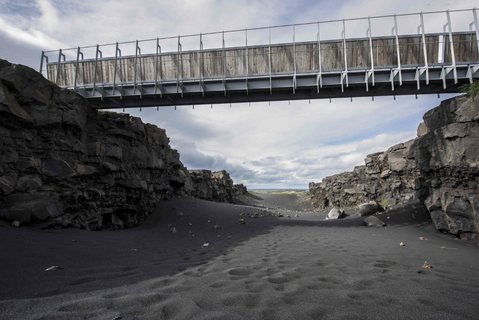
Bridge Between Continents
A footbridge spanning a large fissure that marks the divergent boundary between the North American and Eurasian tectonic plates.
Walk across the bridge to cross between two continents.
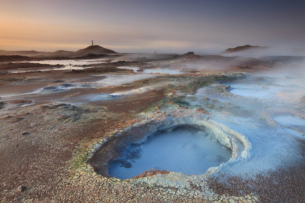
Gunnuhver Hot Springs
A highly active geothermal area featuring mud pools and steam vents with a distinct sulfur odor.
Observe the steam vents from the designated wooden walkways.
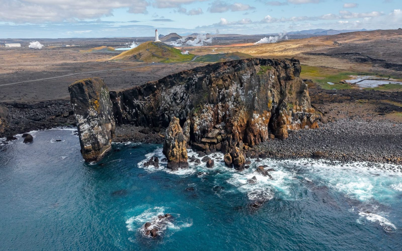
Reykjanesviti Lighthouse
Iceland's oldest lighthouse, situated on a cliff edge near rugged basalt rock formations.
Look for the lighthouse silhouette against the coastal cliffs.
Krýsuvík Geothermal Area
A site characterized by multi-colored hills, boiling mud pots, and geothermal steam vents.
Walk the boardwalks for a close look at the colorful soil.
Valahnúkamöl
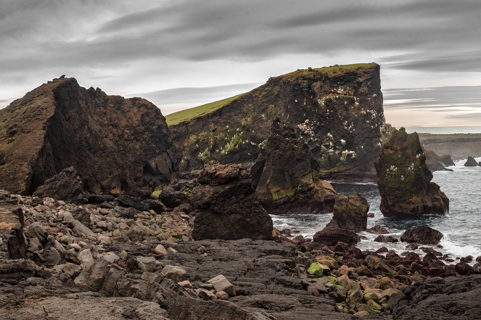
A coastal cliff area where the North American tectonic plate meets the ocean, featuring dramatic rock formations.
View the sea stacks and bird cliffs from the edge.
Safety Rules for the Reykjanes Peninsula Driving Tour
The Reykjanes Peninsula's fragile volcanic landscape and protected geothermal areas require strict adherence to environmental protocols. Off-road driving and unmarked paths cause irreversible damage to moss fields and lava formations.
Do
- Stay on marked roads and designated parking areas at all sites
- Park only in official spaces to avoid damaging fragile moss
- Respect barriers and fences around geothermal zones and cliffs
- Check road conditions at safetravel.is before departure
- Keep a safe distance from steam vents and boiling mud pools
- Carry emergency supplies including water, food, and warm layers
Don't
- Drive off-road or create new tracks across lava fields
- Step on moss-covered areas even if they appear accessible
- Cross barriers at geothermal sites or cliffsides for photos
- Approach nesting bird areas during breeding season, May through August
- Leave litter or disturb geological formations and cairns
- Rely solely on GPS; download offline maps for remote areas
Check availability
Frequently Asked Questions About Reykjanes Peninsula Driving
Everything you need to know about reykjanes peninsula driving tour